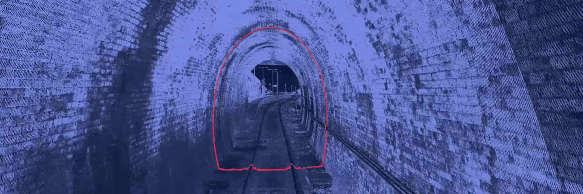
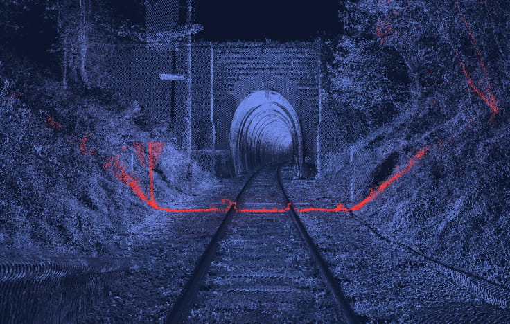
We deliver maintenance efficiency through survey grade data management —at 0.8mm resolution.
By integrating camera and lidar systems, rail engineering, and regulatory expertise, after just one pass, we can trigger 'preventative insights' for track managers.
1:25
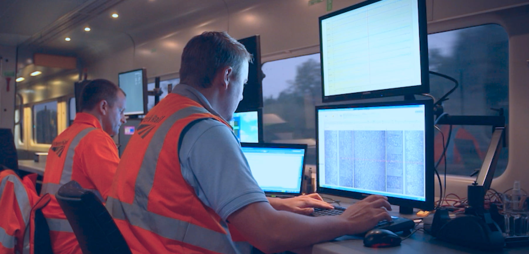
Network Rail: Train-borne monitoring for reduced delays + safer railways.
Another example:
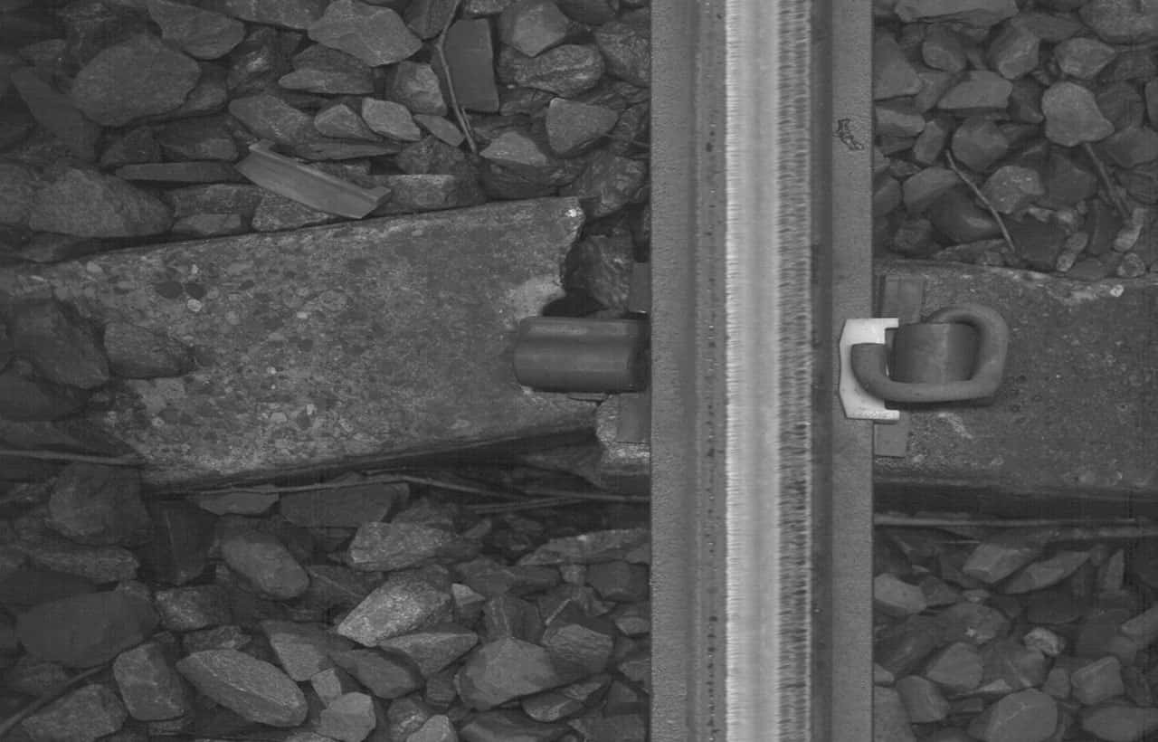
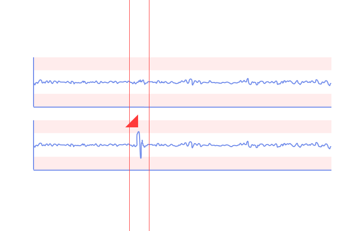
A passenger train found a rail defect. We used mobile monitoring to alert us of the event and the timeline that this occurred.
Replacing inspections with ongoing remote testing
(every operation)
A record of operation, insights on degradation, and informed asset lifespan decisions.
point
conditions
level
crossings
signaling
events
200+ sites
24/7
With labour shortages and the need to optimise rail assets over multiple years, AI will be the maintenance star of the decade. Book a call with us if curious.